About the North Atlantic Coast Comprehensive Study

Map depicting areas covered by the Comprehensive Study

In January 2015, the U.S. Army Corps of Engineers completed a report detailing the results of a two-year study to address coastal storm and flood risk to vulnerable populations, property, ecosystems, and infrastructure affected by Hurricane Sandy in the North Atlantic region of the United States.

The North Atlantic Coast Comprehensive Study is designed to help local communities better understand changing flood risks associated with climate change and to provide tools to help those communities better prepare for future flood risks. It builds on lessons learned from Hurricane Sandy and attempts to bring to bear the latest scientific information available for state, local, and tribal planners.

The conclusions of the study, as detailed in the final report, include several findings, outcomes, and opportunities, such as the use of a nine-step Coastal Storm Risk Management Framework that can be customized for any coastal watershed. 

Risk Management Strategies for Coastal Communities

base map

This map shows various coastal storm damage risk management strategies communities can use to adapt to increased flood risk by 2100 (at a non-specific location). Although specific communities should consider a range of all possible solutions based on site-specific conditions, not all strategies to reduce coastal storm damage risk are structural solutions.  A text-only version of this information is available at the bottom of the page.

Projected Coastal Flood Increases: 2018 to 2118

Shows comparison between the 1-year, 10-year, 50-year, 100-year and 500-year flood levels 99 percent flood : with a 99 percent chance of being equaled or exceeded in nearly every year, often referred to as the annual storm. 10 percent flood : with a 10 percent chance of being equaled or exceeded in nearly every year, often referred to as the 10-year storm. 2 percent flood : with a 2 percent chance of being equaled or exceeded in nearly every year, often referred to as the 50-year storm. 1 percent flood : with a 1 percent chance of being equaled or exceeded in nearly every year, often referred to as the 100-year storm. 0.2 percent flood : with a 0.2 percent chance of being equaled or exceeded in nearly every year, often referred to as the 500-year storm. 2118 2018 2098 2078 2058 2038

Potential Impact of Anticipated Sea Level Change on Coastal Areas by 2100

Potential effects of anticipated sea level change to coastal communities by 2100 (at a non-specific location)

Reduction of Beach Width Reduction of Beach Width Overtopping of Bulkheads Overtopping of Bulkheads Nuisance Flooding Nuisance Flooding Innundation Barrier Islands Inundation Barrier Islands Inundation Low-Lying Roads Inundation Low-Lying Roads Industrial Yards at Water's Edge Industrial Yards at Water's Edge Bridges / Decks Subject to Wave Loading Bridges / Decks Subject to Wave Loading

Geospatial and Modeling Products

Note: Geospatial data and other GIS layers generated as part of the study can be viewed in the USACE CorpsMap viewer. 


sample of geospatial products

NACCS geodatabaseThis database contains vector GIS information from various NACCS geospatial analyses. It also has features used to generate report maps and figures, including base map features. Refer to ArcGIS metadata for more information about each feature. 
 

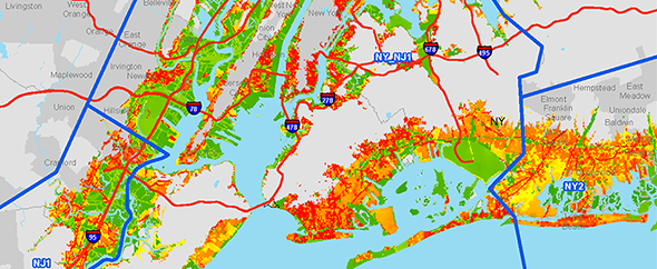
Raster geospatial products: These are raster files presenting results of the NACCS exposure analysis, risk analysis, future mean sea level inundation mapping, and housing density projections. These products were generated using the best available data at the time and may or may not accurately reflect existing or future conditions. Refer to ArcGIS metadata for more information about each file. 

Barrier Island Sea Level Rise Inundation Assessment: The back bays of barrier islands to the bay side of beaches and dunes as well as other areas of the North Atlantic Coast including embayments and harbors are at risk of storm surge and tidal flooding via barrier island inlets. Long Beach Island, New Jersey was identified for the NACCS Barrier Island and Back Bay Example to present an illustrative example of how a beach and dune system would perform based on sea level change inundation scenarios as well as the impacts of coastal flooding from back bay areas. This example is not intended to evaluate the actual coastal storm risk and consequences. Click here to go to access the report.


Coastal Hazards System: The Coastal Hazards System (CHS) is a coastal storm hazard data storage and mining system.  It stores comprehensive, high-fidelity, storm response computer modeling results including climatology, surge, total water levels, waves, and currents and corresponding measurements.  Extremal statistics and epistemic uncertainties of the processes are also stored, and the data are easily accessed, mined, plotted, and downloaded through a user-friendly web interface.  CHS regional data are comprehensive, uniformly spanning the coastal region and practical probability space. The CHS is available online at https://chs.erdc.dren.mil/.


Sea Level Affecting Marshes Model update algorithm: This algorithm has only been implemented as a stand-alone FORTRAN code; implementation into SLAMM is done by the developers to maintain consistent code management. 

Primary Productivity
For the purposes of this algorithm, primary productivity refers only to wetland vegetation; it includes both above- and below-ground production. Both mechanisms are lumped into a general organic production term, which then is used to modify bed elevation.The algorithm includes both primary productivity and marsh collapse. 

Source Material
This algorithm is based on the relative elevation sub-model presented in the following source:
Couvillion, Brady R., Gregory D. Steyer, Hongqing Wang, Holly J. Beck, and John M. Rybczyk (2013). “Forecasting the Effects of Coastal Protection & Restoration Projects on Wetland Morphology in Coastal Louisiana under Multiple Environmental Uncertainty Scenarios” Journal of Coastal Research: Special Issue 67 - Louisiana′s 2012 Coastal Master Plan Technical Analysis: 29-50. 2013.

Risk Management Measures

Collapse All Expand All
 About the Risk Management Strategies for Coastal Communities Clicking the numbered links below brings up static images corresponding to the animated GIFs from the map above; clicking each bolded topic header expands more information about that topic.

The above map, titled Risk Management Strategies for Coastal Communities, shows various coastal storm damage risk management strategies communities can use to adapt to anticipated base flood level change by 2100. Not all strategies to reduce coastal storm damage risk are structural solutions.

Communities should consider adopting a combination of strategies -- including Structural, Non-structural, and Natural or Nature-Based solutions -- that emphasize wise use of the floodplain and programmatic measures to manage risk. Below is a range of strategies available to reduce future coastal storm damage risk to coastal communities.

Although specific communities should consider a range of all possible solutions based on site-specific conditions, not all strategies to reduce coastal storm damage risk are structural solutions.

 Non-structural:   1. Acquisition and relocation 

Often considered a drastic approach to storm damage reduction, property acquisition and structure removal are usually associated with frequently damaged structures.

Implementation of other measures may be effective but if a structure is subject to repeated storm damage, this measure may represent the best alternative to eliminating risks to the property and residents.

 Non-structural:   2. Building retrofit

A non-elevated structure in the flood zone is prone to flooding.

Building retrofit measures include elevation of a structure or possibly dry flood proofing of a structure.

Elevation of a structure is usually limited to smaller residential and commercial buildings.

Whether a  structure may be elevated depends on a number of factors, including the foundation type, wall type, size of structure, condition, etc.

Flood warning systems and evacuation planning are applicable to vulnerable areas.

Despite improved tracking and forecasting techniques, the uncertainty associated with the size of a storm, the path, or its duration necessitate that warnings be issued as early as possible.

Evacuation planning is imperative for areas with limited access, such as barrier islands, high density housing areas, elderly population centers, cultural resources, and areas with limited transportation options.

Communities participating in the National Flood Insurance Program are proactive in promoting floodplain management and  flood risk awareness.

 Structural:   5.   Deployable floodwalls
Rapid Deployment Floodwalls are structures that are temporarily erected along the banks of a river or estuary, or in the path of floodwaters. Rapid Deployment Floodwalls also prevent water from reaching the area behind the structure and are usually used in locations where space is limited.
 Structural:   6.   Floodwalls
Floodwalls are structures used to prevent flooding and to protect relatively small areas or areas with limited space for large flood protection measures. Floodwalls  are most frequently used in urban and industrial areas.
 Structural:   7.   Levees

Levees and dikes are embankments constructed along a waterfront to prevent flooding in relatively large areas for high levels of flood risk. If a levee or dike is located in an erosive shoreline environment, revetments may be needed on the waterfront side for more protection from erosion.

 Structural:   8.   Seawalls

Seawalls, are typically massive structures whose primary purpose is interception of waves and reduction of wave-induced overtopping and flooding.

Note that under this definition seawalls do not include structures with the principal function of reducing flood risk to low-lying coastal areas. 

In those cases a high, impermeable, armored structure known as a sea dike is typically required to prevent coastal flooding.

 Structural:   9.   Revetments

Revetments are onshore structures with the principal function of protecting the shoreline from erosion.

Revetments typically consist of a cladding of stone, concrete, or asphalt to armor sloping natural shoreline profiles.

 Structural:   10. Bulkheads

Bulkheads primarily retain soil and experience little to no wave action.

 Structural:   11.  Storm surge barriers

Storm surge barriers reduce risk to estuaries against storm surge flooding and waves.

In most cases the barrier consists of a series of movable gates that normally stay open under normal conditions to let the flow pass but are closed when storm surges are expected to exceed a certain level.

Storm surge barriers are often chosen as a preferred alternative to close off estuaries and reduce the required length of flood protection measures behind the barriers.

Storm surge barriers are typically opened during normal conditions to allow for navigation and saltwater exchange with the estuarine areas landward of the barrier.

 Structural / Natural and nature-based features  12. Beach restoration
Relatively narrow beach and low dunes fronting a typical beachfront development. A beach with beach fill has a wide berm and high, vegetated dunes.
 Structural / Natural and nature-based features   13. Beach restoration and breakwaters

Narrow beach and low dunes fronting a typical beachfront development.

Wide and narrow beach with breakwaters in front of beach, less wave exposure.

Breakwaters reduce the amount of wave exposure.

 Structural / Natural and nature-based features   14. Beach restoration and groins

On some coastlines, there is more sand leaving the area via longshore sediment transport than there is sand arriving to replace it. Such beaches are eroding and are typically very narrow.

Groins are structures that extend perpendicularly from the shoreline. Groins are usually built to stabilize a stretch of natural or artificially nourished beach against erosion that is due primarily to a net longshore loss of beach material.

The effect of a single groin is accretion of beach material on the updrift side and erosion on the downdrift side.

 Structural / Natural and nature-based features   15. Drainage improvements

A drainage system can carry water away via conveyance systems and, during times of high water, may store water until it can be carried away in storage facilities. 

Conveyance systems utilize measures such as pump stations, culverts, drains, and inlets to remove water from a site quickly and send it to larger streams.

Storage facilities are used to store excess water until the storm or flood event has ended.

 Structural / Natural and nature-based features   16. Living shorelines

Open and exposed shorelines are prone to erosion due to waves.

Living shorelines are essentially tidal wetlands constructed along a shoreline to reduce coastal erosion.

Living shorelines maintain dynamic shoreline processes, and provide habitat for organisms such as fish, crabs and turtles.

An essential component of a living shoreline is constructing a rock structure (breakwater/sill) offshore and parallel to the shoreline to serve as protection from wave energy that would impact the wetland area and cause erosion and damage or removal of the tidal plants.

 Natural and nature-based features   17. Overwash fans

Overwash fans are a component of the sediment budget of barrier islands.

Overwash fans are believed to be a relevant process in the rollover or retreat mechanism of some coastal barriers in response to sea level rise.

 Natural and nature-based features   18. Reefs

The development of artificial reefs in bays provides a means to reestablish and enhance reef communities.

Artificial reefs provide shoreline erosion protection.

Artificial reefs are established for various reasons, amongst others:

  • restore degraded or damaged natural reefs
  • provide three dimensional habitat structure above the bottom

  • provide fishing and scuba diving opportunities

 Natural and nature-based features   19. Submerged aquatic vegetation

Submerged Aquatic Vegetation performs many important functions, including:

  • wave attenuation and sediment stabilization,
  • water quality improvement,
  • primary production,
  • food web support for secondary consumers, and
  • provision of critical nursery and refuge habitat for fisheries species.
 Natural and nature-based features   20. Wetlands

The dense vegetation and shallow waters within wetlands can slow the advance of storm surge somewhat and slightly reduce the surge landward of the wetland or slow its arrival time.


Wetlands can also dissipate wave energy; potentially reducing the amount of destructive wave energy propagating on top of the surge, though evidence suggests that slow-moving storms and those with long periods of high winds that produce marsh flooding can reduce this benefit.


Click here for a different view of the animation to the right.


Contact Us

E-mail: dll-cenado-pa@usace.army.mil

Phone: 347-370-4548

Webinars / presentations

Collapse All Expand All
 Stakeholder webinar, Feb. 2, 2015
 Strategies & Management Measures webinar, April 3, 2014
 NNBF Policy & Technical mtgs., Nov. 20-22, 2013
 Risk, Exposure & Vulnerability webinar, April 4, 2014
 
 Numerical Modeling & Climate Change webinar, Sept. 12, 2013
 Ecosystems Goods & Services webinar, Aug. 29, 2013
 Institutional & Other Barriers webinar, Apr. 1, 2014
 Sea Level Rise & Climate Change Adaptation Planning webinar, April 8, 2014
 Policy Challenges & Institutional Barriers webinar, Dec. 19, 2013
 Nature-Based Features, July 30, 2013
 Vulnerable Community Identification webinar, Sept. 25, 2013
 Water Resources Science, Engineering & Planning: Coastal Risk Reduction, Dec. 17-18, 2013
 Draft Analyses webinar, March 19, 2014
 Regional Sediment Management webinar, June 24, 2014